Colorado
The regions of Colorado in which I have spent considerable time are Rocky
Mountain National Park, Dinosaur National Monument, and the San Juan mountains of
south western Colorado. Rocky Mountain National Park (RMNP) is truly spectacular
and I have done some wonderful hikes in both summer and winter there. However,
my pictures of RMNP are all slides so this page concentrates on the other two
regions I have visited.
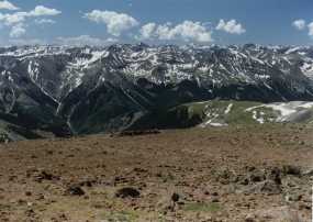
San Juans - SW Colorado
| The San Juans of south western Colorado contain a number of 14,000 foot peaks,
lots of backcountry dirt and 4WD roads, and many spectacular trails. Yankee Boy
basin at the foot of Mt. Sneffels and American Basin at the foot of Handie's Peak
are two of my favorite spots. I have climbed both of the preceding 14'ers with a
2 year old on my back. Another favorite area is Ice Lakes just north of Silverton.
I did them first with my daughter Akilah and then later as a family.
In 2011 my (then 11 year old) son and I did a short backup up to tree line and
camped next to a nice stream. The following day we did Redcloud. (Note my flip flops!)
In 2012 we did Handies peak, camping at 13,000' the night before. Later in the summer
we backed up to Highland Mary Lakes for a couple of days.
|
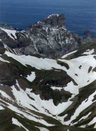
|
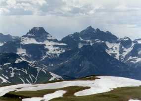
| View from Redcloud |
|
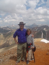
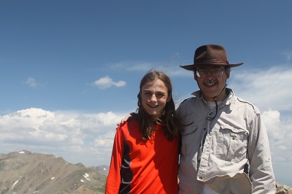
| Jack & Kiernan on top of Redcloud |
|
 |
 |
 |
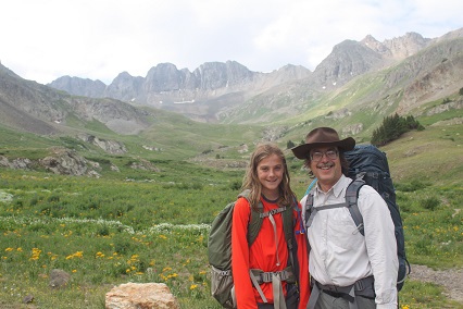
| At Handies Trailhead |
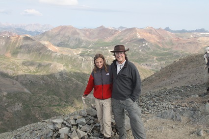
On top of Handies Peak |
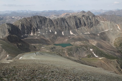
Sloan Lake (Am Basin) campsite from Handies |
The following pictures are from Uncompaghre Peak, another
14'er. I did the climb wearing Tevas (and socks) and carrying an ice axe. We did
cross a number of snow fields and did some glissading on the way down.
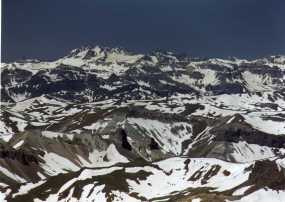
Central Colorado - Sawatch Range
Central Colorado contains the mighty Sawatch Range - a string of 14'ers including the
"University Peaks". Also included are the famous ski areas, Vail, Breckenridge, etc. During WWII,
the 10th Mountain Division trained in this area, and have since resurrected / built a series of huts
for winter cross country ski use - spectacular! My experiences have so far been somewhat limited.
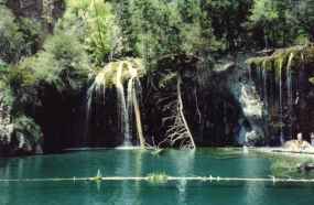
Glenwood Springs is located in a rather spectacular canyon with a great bike trail. Off of this is a
short, steep, hike to the spectacular Hanging Valley, including lake (photo below) and a waterfall
gushing out of the middle of a cliff face.
 |
 |
| Hanging Lake near Glenwood Springs |
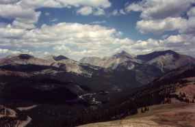
View from Monarch Pass |
A bit more remote for most people, is Great Sand Dunes National Monument, at the foot of the
Sangre de Cristos, stretching north from New Mexico. Towering over Great Sand Dunes are the Crestone
Peaks and Kit Carson (14'ers), where I ran into one of the worst storms I've ever encountered. A friend
and I hiked up to upper South Colony Lake (+12,000') in mid-August. South Colony Lake is located in a high
cirque, surrounded by 4 14,000' peaks. Just as we got to the lake it started to rain so we setup our tent
and ducked inside, figuring it was the typical afternoon thunderstorm. The rain turned to snow for a while,
then let up. We crawled out, had dinner, and explored around the area a bit, including seeing some Big
Horn Sheep wander through our camp. Then the wind picked up, the rain started, and the clouds settled down.
Watching the clouds roll down the mountains was impressive. We finally gave up and crawled into our sleeping
bags, figuring it would blow over by morning. Turns out we got almost no sleep - the wind howled almost
constantly all night, banging the tent and the rain was pounding on the tent relentlessly. Come morning, and
the storm was still raging, we thought it would burn off shortly. Instead, it kept getting worse, the wind
was amazing and just kept getting stronger, blowing rain in torrential sheets. Finally we decided this trip
was doomed and decided to break camp. It took two of us to hold the tent, trying to get it down. We ended
up soaked to the skin. A few hundred feet elevation, back down the mountain and while it was still overcast,
it was quite and only list mist in the air. I've seen longer storms, but none of that sustained intensity.
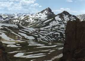
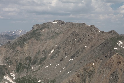
In 2014 Kiernan & I did Columbia & Harvard (3rd highest in CO at 14,421')
in 1 day - that was grueling!
We backpacked in to a short ways below tree line and set up base camp. The morning
we did a tough scramble up the extremely steep scree slope leading to Columbia and
gained the peak before 11 AM. Then things got difficult. We did not want to try
the narrow, semi-technical ridge line with cliffs dropping off on both sides going
across to Harvard, so we descended into a boulder field and then back up a steep
grassy slope. A thunderstorm rolled by a bit to our west. As we regained the trail
near the summit of Harvard we had to step off the trail to allow a resident mountain
goat to pass. We finally summitted at 5 PM and then had the long steep trail back
down. We reached camp after dark. As I recall, a very hard 14 hour day!
 |
 |
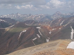
| Mt Harvard from Mt Columbia |
On top of Mt. Columbia |
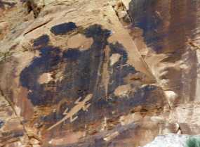
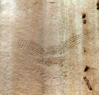
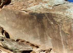
Dinosaur National Monument
Dinosaur is best known for the fossil dinosaur bones, but I find the canyon
country much more interesting. The following are a few petroglyphs from both the
Utah (bones) portion and the Colorado (canyon) portion of the monument.